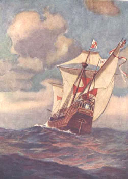

Columbus kept a detailed log of his first voyage, which has been lost. However the abstract of the log, made by Bartolome de Las Casas,called the Diario, remains with us today. This document contains the courses and distances sailed by the fleet every day of the voyage. In addition to the Diario, the biography of Columbus by his son Fernando contains some more material.
On the westbound passage many of the daily distances in the Diario are given twice, one figure being Columbus's own true figure, and a smaller number which was (according to Las Casas) a false number given publicly to allay fears of the crew that they had sailed too far from Spain. But this story has been doubted by many, because most of the crew were experienced mariners in their own right, and they were certainly just as able to determine the distance sailed as was Columbus.
In 1983, James E. Kelley Jr. proposed another reason for these two figures. Kelley noticed that the true and false numbers tend to cluster around a ratio of 6 to 5. This is quite close to the ratio between the Italian or Geometric league of 2.67 nautical miles, and the Portuguese Maritime league of 3.2 nautical miles. Kelley proposed that Columbus was using the Italian league, while the Spanish sailors were using the Portuguese Maritime League; the double bookkeeping was then simply an artifact of Columbus converting between the two units of measure, although these conversions were sometimes haphazard, and were misunderstood by Las Casas.
When one examines various sources, one finds that there are six reports of longitude giving five different results. And these results differ from each other by as much as 90 degrees of longitude. In addition if Columbus had found his longitude by comparing the time of the eclipse he observed to the prediction in the almanac, not one of these reports would be correct.
But why would Columbus falsify such a result? A clue can be found in Columbus's Book of Privileges. Prior to both his second and third voyages, Columbus requested that the Spanish Sovereigns confirm his appointments as Admiral of the Ocean Sea and Viceroy of the newly discovered lands. The documents confirming these privileges confine the Admiral's realm only to "the Ocean Sea in the region of the Indies". Therefore, if the newly discovered lands were not really in the region of the Indies - that is, in Asia - Columbus's entire fortune may have been at risk.
The impact of Columbus's fraud may have been felt by Amerigo Vespucci, his friend and correspondent. Ironically Vespucci, unaware of Columbus's fraud, very likely plagiarized Columbus' result for longitude when he constructed his own longitude fraud in 1499.
Those who have studied Columbus will not be surprised that he was capable of deception, for this is not the first such instance recorded or suggested. Columbus certainly has to be questioned about his reliability as an objective observer. Before the invention of accurate clocks, it was nearly impossible for sailors to find longitude. Columbus made two attempts to measure his longitude using eclipses. His results were pretty bad, even by the standards of his day.
The only practical method for determining longitude in the fifteenth century was a well-known method of timing lunar eclipses. The eclipse timing method is simple: first, you determine the local time that the lunar eclipse starts or ends by direct observation. Then you compare your local time for that event against the local time at some distant place. The difference in the two times is the difference in longitude. For example, if the eclipse starts at 8:00 p.m. where you are (say, in Cuba), and the same eclipse starts at 1:00 a.m. in Cadiz, you find that there is five hours difference between Cuba and Cadiz. This works out to 75 degrees of longitude.
We now know that observers can tell the moment a lunar eclipse starts or ends to within a few minutes. That means that the biggest source of error for Columbus would have been finding the correct local time. But this is also easy: in the tropics, the sun rises at nearly 6:00 a.m. and sets nearly 6:00 p.m. every day. Also, sailors used a device called a nocturnal which was used to determine the time of midnight from the positions of the circumpolar stars.
Using these clues and a sandglass, Columbus should have been able to determine the correct local time of an eclipse to within about ten minutes. However Columbus's eclipse timing longitudes are off by much greater amounts than this. His 1494 longitude had an error of an hour and 20 minutes. Columbus's error in 1504 is even worse from Jamaica, his error was two and a half hours.
The best way to explain the errors is to assume that Columbus didn't really use the lunar eclipses at all. He worked out his longitude by dead reckoning and fiddled the figures for the eclipses to agree with the distance he had sailed, converted to longitude on the basis of what size he thought he world was. He used his dead-reckoning distances, and claimed that they were celestially determined. This was probably done to make his results look respectable.